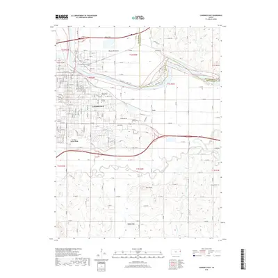
2018 Map of Lawrence East
USGS Topo · Published 2018About this map
The Kansas River divides the eastern landscape of Lawrence, winding past Bismark Grove while the Kansas Tpke (Interstate 70) cuts across the northern floodplain. This area is a significant hub for local genealogy, containing several large burial grounds including Oak Hill Cem, Memorial Park Cem, and Mount Calvary Catholic Cem. The southern half of the map transitions into the drainage of the Wakarusa River, where the terrain rises toward Blue Mound.
Find a feature on this map
176 named features on this map. Tap any name to fly to it.
Don’t see what you’re looking for? This feature index may not catch every label — zoom into the map to look around manually.
Map Details
Editions of this 2018 Lawrence East Map
This is the sole edition of this map. No revisions or reprints were ever made.
Other maps of this area

1885 · Lawrence
USGS Topo · 1:125,000

1886 · Oskaloosa
USGS Topo · 1:125,000

1888 · Oskaloosa
USGS Topo · 1:125,000

1889 · Lawrence
USGS Topo · 1:125,000

1894 · Oskaloosa
USGS Topo · 1:125,000

1947 · Lawrence
USGS Topo · 1:250,000

1949 · Williamstown
USGS Topo · 1:24,000

1950 · Kansas City
USGS Topo · 1:250,000

1950 · Williamstown
USGS Topo · 1:24,000

1950 · Lawrence
USGS Topo · 1:250,000