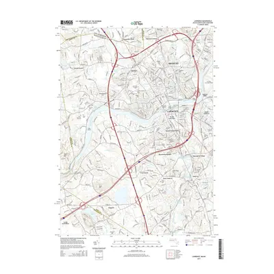
2015 Map of Lawrence
USGS Topo · Published 2015About this map
The Merrimack River serves as the industrial and geographical spine of this 2015 U.S. Geological Survey representation of Lawrence and its surrounding communities. Spanning the Essex and Middlesex county lines, the map details the dense urban core of South Lawrence and Methuen, where historic infrastructure like the O'Reilly Bridge, Duck Bridge, and Casey Bridge cross the central waterway. The landscape is marked by a significant concentration of local heritage sites, including numerous religious burial grounds such as Saint Marys Cem, Lithuanian Cem, and Sons of Israel Cem, which reflect the region's diverse immigrant history.
Find a feature on this map
94 named features on this map. Tap any name to fly to it.
Don’t see what you’re looking for? This feature index may not catch every label — zoom into the map to look around manually.
Map Details
Editions of this 2015 Lawrence Map
This is the sole edition of this map. No revisions or reprints were ever made.
Other maps of this area

1886 · Lawrence
USGS Topo · 1:62,500

1886 · Lowell
USGS Topo · 1:62,500

1888 · Haverhill
USGS Topo · 1:62,500

1888 · Lawrence
USGS Topo · 1:62,500

1890 · Haverhill
USGS Topo · 1:62,500

1893 · Lowell
USGS Topo · 1:62,500

1893 · Lawrence
USGS Topo · 1:62,500

1893 · Haverhill
USGS Topo · 1:62,500

1905 · Manchester
USGS Topo · 1:62,500

1918 · Lowell
USGS Topo · 1:62,500