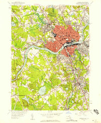
1955 Map of Lawrence
USGS Topo · Published 1958About this map
Industrial Lawrence sits at the heart of this mid-century survey, where the Merrimack River powers the urban core and the Boston and Maine Railroad provides the vital transportation infrastructure. To the south, Andover presents a distinct academic character, featuring the expansive grounds of Phillips Academy, Abbott Academy, and Merrimack College. The landscape is dotted with numerous parochial institutions and burial grounds, such as St Marys Cemetery and St Francis Seminary, reflecting the area's deep-rooted community history.
Find a feature on this map
98 named features on this map. Tap any name to fly to it.
Don’t see what you’re looking for? This feature index may not catch every label — zoom into the map to look around manually.
Map Details
Editions of this 1955 Lawrence Map
This is the sole edition of this map. No revisions or reprints were ever made.
Other maps of this area

1886 · Lawrence
USGS Topo · 1:62,500

1886 · Lowell
USGS Topo · 1:62,500

1888 · Haverhill
USGS Topo · 1:62,500

1888 · Lawrence
USGS Topo · 1:62,500

1890 · Haverhill
USGS Topo · 1:62,500

1893 · Lowell
USGS Topo · 1:62,500

1893 · Lawrence
USGS Topo · 1:62,500

1893 · Haverhill
USGS Topo · 1:62,500

1905 · Manchester
USGS Topo · 1:62,500

1918 · Lowell
USGS Topo · 1:62,500