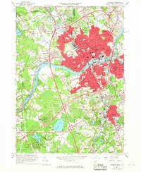
1966 Map of Lawrence
USGS Topo · Published 1968About this map
The Merrimack River serves as the industrial and geographical spine of this mid-1960s study, dividing the dense urban centers of Lawrence and Methuen from the expanding suburban reaches of Andover and North Andover. The map reveals a landscape in transition, where the heavy infrastructure of the Boston and Maine railroad and historic textile-era density meet the modern arrival of Interstate 93 and Interstate 495. This era of development is juxtaposed against deep-rooted institutional history, including the campuses of Phillips Academy and Merrimack College.
Find a feature on this map
129 named features on this map. Tap any name to fly to it.
Don’t see what you’re looking for? This feature index may not catch every label — zoom into the map to look around manually.
Map Details
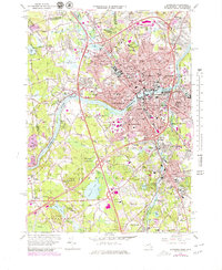
Editions of this 1966 Lawrence Map
2 editions found
Other maps of this area

1886 · Lawrence
USGS Topo · 1:62,500

1886 · Lowell
USGS Topo · 1:62,500

1888 · Haverhill
USGS Topo · 1:62,500

1888 · Lawrence
USGS Topo · 1:62,500

1890 · Haverhill
USGS Topo · 1:62,500

1893 · Lowell
USGS Topo · 1:62,500

1893 · Lawrence
USGS Topo · 1:62,500

1893 · Haverhill
USGS Topo · 1:62,500

1905 · Manchester
USGS Topo · 1:62,500

1918 · Lowell
USGS Topo · 1:62,500