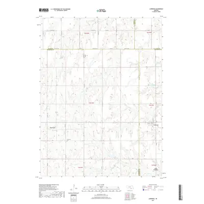
2017 Map of Lawrence
USGS Topo · Published 2017About this map
The agrarian landscape of Nuckolls County, Nebraska, is defined by a grid of rural roads and the drainage networks of Oak Creek and Liberty Creek. This 2017 survey details the area surrounding the village of Lawrence, where local infrastructure like Dolnicek Reservoir and Mazour Reservoir supports the region's agricultural requirements. The map serves as a valuable resource for genealogists, marking the locations of historical burial sites such as Oak Creek Cem and Presbyterian Cem.
Find a feature on this map
51 named features on this map. Tap any name to fly to it.
Don’t see what you’re looking for? This feature index may not catch every label — zoom into the map to look around manually.
Map Details
Editions of this 2017 Lawrence Map
This is the sole edition of this map. No revisions or reprints were ever made.
Other maps of this area

1898 · Superior
USGS Topo · 1:125,000

1955 · Grand Island
USGS Topo · 1:250,000

1957 · Grand Island
USGS Topo · 1:250,000

1958 · Grand Island
USGS Topo · 1:250,000

1960 · Deweese
USGS Topo · 1:24,000

1969 · Fairfield NW
USGS Topo · 1:24,000

1969 · Lawrence
USGS Topo · 1:24,000

1969 · Blue Hill
USGS Topo · 1:24,000
1969 · Ayr
USGS Topo · 1:24,000
1969 · Pauline
USGS Topo · 1:24,000