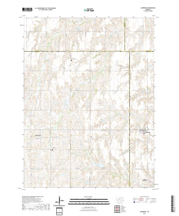
2021 Map of Lawrence
USGS Topo · Published 2021About this map
Lawrence stands as the primary settlement in this corner of south-central Nebraska, situated where the borders of Nuckolls, Webster, Clay, and Adams counties converge. The landscape is defined by the headwaters and drainages of Liberty Cr and Oak Cr, which carve a dendritic pattern through the agricultural plains. Small community centers such as Rosemont and Saint Stephens anchor the rural sections, while local history is preserved at the Oak Creek Cem and Presbyterian Cem. The presence of the Mazour Reservoir and Dolnicek Reservoir indicates the importance of managed water resources in this prairie environment. This modern survey illustrates how long-established section lines and county roads like Blue Valley Rd continue to organize the region's movement and land use, following patterns set by early homesteaders and the reach of the rail lines that once fostered these towns.
Find a feature on this map
34 named features on this map. Tap any name to fly to it.
Don’t see what you’re looking for? This feature index may not catch every label — zoom into the map to look around manually.
Map Details
Editions of this 2021 Lawrence Map
This is the sole edition of this map. No revisions or reprints were ever made.
Other maps of this area

1898 · Superior
USGS Topo · 1:125,000

1955 · Grand Island
USGS Topo · 1:250,000

1957 · Grand Island
USGS Topo · 1:250,000

1958 · Grand Island
USGS Topo · 1:250,000

1960 · Deweese
USGS Topo · 1:24,000

1969 · Fairfield NW
USGS Topo · 1:24,000

1969 · Lawrence
USGS Topo · 1:24,000

1969 · Blue Hill
USGS Topo · 1:24,000
1969 · Ayr
USGS Topo · 1:24,000
1969 · Pauline
USGS Topo · 1:24,000