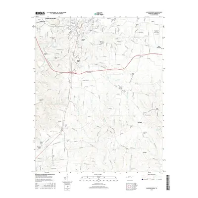
2016 Map of Lawrenceburg
USGS Topo · Published 2016About this map
Lawrenceburg serves as the focal point of this Lawrence County landscape, where the residential expansion of Hickory Heights and the infrastructure of the Lawrenceburg-Lawrence County Airport meet the winding waters of Shoal Creek. The topography is defined by sharp elevation shifts at Raven Bluff and the prominent Wildcat Ridge, overlooking the New Shoal Cr Reservoir. This area preserves a high density of small-town burial grounds and rural places of worship, such as Fuller Chapel Cem and Wesley Chapel Cem, which anchor the smaller outlying communities of Leoma and Crossroads. The transport network includes the historic Old Waynesboro Hwy and Old Florence Pulaski Rd, reflecting the long-established transit corridors through middle Tennessee. To the south, the terrain becomes more dissected by numerous branches like Love Br and Butler Br, creating a pattern of ridge-top settlements and creek-bottom agriculture.
Find a feature on this map
78 named features on this map. Tap any name to fly to it.
Don’t see what you’re looking for? This feature index may not catch every label — zoom into the map to look around manually.
Map Details
Editions of this 2016 Lawrenceburg Map
This is the sole edition of this map. No revisions or reprints were ever made.
Other maps of this area

1936 · Deerfield
USGS Topo · 1:24,000

1936 · Campbellsville
USGS Topo · 1:24,000

1936 · Lawrenceburg
USGS Topo · 1:24,000

1936 · Ethridge
USGS Topo · 1:24,000

1936 · Long Branch
USGS Topo · 1:24,000

1936 · Loretto
USGS Topo · 1:24,000

1936 · Bodenham
USGS Topo · 1:24,000

1936 · Appleton
USGS Topo · 1:24,000

1936 · Bonnertown
USGS Topo · 1:24,000
1948 · Appleton
USGS Topo · 1:24,000