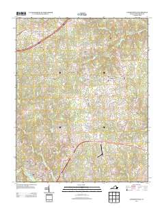
2013 Map of Lawrenceville
USGS Topo · Published 2013About this map
Lawrenceville serves as the primary hub of this Brunswick County landscape, where the town street grid is bounded by Great Cr to the south and Roses Cr to the east. The geography is defined by a dense network of tributaries feeding into Sturgeon Cr and Wilson Cr, with rural settlements like Dolphin and Edgerton anchoring the outlying crossroads. Historically significant travel routes are preserved in names such as Old Stage Rd and Old Tobacco Dr, reflecting the area's agricultural foundations. Modern infrastructure is represented by the Lawrenceville/Brunswick Municipal Airport, which sits just north of the community of Wesson. Small-scale place names such as Cool Spring and Naptha punctuate the northern sections, while the map records numerous creek crossings and family-named roads like Goldsberry Ln and Nathaniel Ln, which provide valuable location data for genealogical research in this part of Virginia.
Find a feature on this map
100 named features on this map. Tap any name to fly to it.
Don’t see what you’re looking for? This feature index may not catch every label — zoom into the map to look around manually.
Map Details
Editions of this 2013 Lawrenceville Map
This is the sole edition of this map. No revisions or reprints were ever made.
Other maps of this area

1918 · Lawrenceville
USGS Topo · 1:62,500

1919 · Mc Kenney
USGS Topo · 1:48,000

1919 · White Plains
USGS Topo · 1:48,000

1919 · Emporia
USGS Topo · 1:62,500

1920 · Lawrenceville
USGS Topo · 1:48,000

1920 · White Plains
USGS Topo · 1:62,500

1921 · Mc Kenney
USGS Topo · 1:62,500

1921 · Lawrenceville
USGS Topo · 1:62,500

1942 · Lawrenceville
USGS Topo · 1:62,500

1942 · Emporia
USGS Topo · 1:62,500