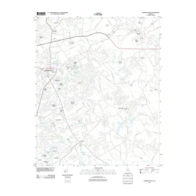
2011 Map of Lawrenceville
USGS Topo · Published 2011About this map
Lawrenceville and its surrounding suburbs appear here during a period of significant residential expansion in Gwinnett County. The map captures a transition from rural homesteads to modern developments, as seen in the densifying neighborhoods of Sandlewood, Acadia Woods, and Waverly Woods. Despite this growth, older land-use patterns remain visible through several water-control structures like Powell Dam and Kennerly Dam, and the prominent Grayson Quarry in the south.
Find a feature on this map
100 named features on this map. Tap any name to fly to it.
Don’t see what you’re looking for? This feature index may not catch every label — zoom into the map to look around manually.
Map Details
Editions of this 2011 Lawrenceville Map
This is the sole edition of this map. No revisions or reprints were ever made.
Other maps of this area

1888 · Atlanta
USGS Topo · 1:125,000

1890 · Suwanee
USGS Topo · 1:125,000

1890 · Atlanta
USGS Topo · 1:125,000

1891 · Gainesville
USGS Topo · 1:125,000

1892 · Atlanta
USGS Topo · 1:125,000

1894 · Suwanee
USGS Topo · 1:125,000

1895 · Atlanta
USGS Topo · 1:125,000

1896 · Monroe
USGS Topo · 1:125,000

1953 · Atlanta
USGS Topo · 1:250,000

1953 · Athens
USGS Topo · 1:250,000