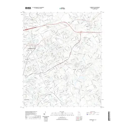
2020 Map of Lawrenceville
USGS Topo · Published 2020About this map
The Gwinnett County seat at Lawrenceville serves as the focal point of this suburban-rural landscape, where modern transportation corridors like University Pkwy and Sugarloaf Pkwy intersect with historical land divisions. This 2020 map documents the transition of the region from an agrarian past into a growing metropolitan hub, yet it preserves the locations of numerous family and church burial grounds that define its genealogy. Smaller settlements like Dacula, Grayson, and New Hope surround the central city, connected by a network of waterways including the Alcovy River, Yellow River, and Drowning Cr. Local history is anchored at the Gwinnett County Courthouse and the Gwinnett County Airport - Briscoe Field, while residential expansion is balanced by open spaces such as Lawrenceville City Lake and Arnold Lake.
Find a feature on this map
50 named features on this map. Tap any name to fly to it.
Don’t see what you’re looking for? This feature index may not catch every label — zoom into the map to look around manually.
Map Details
Editions of this 2020 Lawrenceville Map
This is the sole edition of this map. No revisions or reprints were ever made.
Other maps of this area

1888 · Atlanta
USGS Topo · 1:125,000

1890 · Suwanee
USGS Topo · 1:125,000

1890 · Atlanta
USGS Topo · 1:125,000

1891 · Gainesville
USGS Topo · 1:125,000

1892 · Atlanta
USGS Topo · 1:125,000

1894 · Suwanee
USGS Topo · 1:125,000

1895 · Atlanta
USGS Topo · 1:125,000

1896 · Monroe
USGS Topo · 1:125,000

1953 · Atlanta
USGS Topo · 1:250,000

1953 · Athens
USGS Topo · 1:250,000