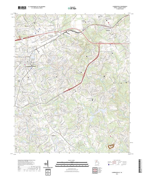
2024 Map of Lawrenceville
USGS Topo · Published 2024About this map
The Gwinnett County Courthouse stands at the center of this 2024 survey, reflecting the area's development from a regional seat into a major suburban hub. The map detail highlights several layers of local heritage, including the Lawrenceville Historic Sem and numerous small burial grounds such as Old Shadowlawn Cem and Walnut Grove Cem. Modern infrastructure like the Gwinnett County Airport/Briscoe Field and major thoroughfares like Sugarloaf Pkwy intersect with the natural drainage of the Alcovy River and Shoal Creek. To the northeast, the settlement of Dacula is visible alongside the CSX Transportation line, while the southern portion of the sheet transitions through Grayson toward the headwaters of Big Haynes Creek. The concentration of churches and associated cemeteries, such as Hebron Baptist Church Cem, provides a detailed record of established communities that persist amid contemporary growth.
Find a feature on this map
52 named features on this map. Tap any name to fly to it.
Don’t see what you’re looking for? This feature index may not catch every label — zoom into the map to look around manually.
Map Details
Editions of this 2024 Lawrenceville Map
This is the sole edition of this map. No revisions or reprints were ever made.
Other maps of this area

1888 · Atlanta
USGS Topo · 1:125,000

1890 · Suwanee
USGS Topo · 1:125,000

1890 · Atlanta
USGS Topo · 1:125,000

1891 · Gainesville
USGS Topo · 1:125,000

1892 · Atlanta
USGS Topo · 1:125,000

1894 · Suwanee
USGS Topo · 1:125,000

1895 · Atlanta
USGS Topo · 1:125,000

1896 · Monroe
USGS Topo · 1:125,000

1953 · Atlanta
USGS Topo · 1:250,000

1953 · Athens
USGS Topo · 1:250,000