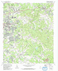
1992 Map of Lawrenceville
USGS Topo · Published 1992About this map
Lawrenceville serves as the focal point of this 1990s Gwinnett County study, showing the city's expansion alongside the CSX Transportation railroad. The map highlights the civic core centered on the Courthouse and the nearby Shadowlawn Cemetery, while the surrounding landscape reveals a network of older rural identifiers. Family names are preserved through landmarks like the McMillan Cem and Loveless Cem, while the spiritual life of the area is anchored by sites like the Lawrenceville Camp Ground and Chestnut Grove Ch.
Find a feature on this map
107 named features on this map. Tap any name to fly to it.
Don’t see what you’re looking for? This feature index may not catch every label — zoom into the map to look around manually.
Map Details
Editions of this 1992 Lawrenceville Map
This is the sole edition of this map. No revisions or reprints were ever made.
Other maps of this area

1888 · Atlanta
USGS Topo · 1:125,000

1890 · Suwanee
USGS Topo · 1:125,000

1890 · Atlanta
USGS Topo · 1:125,000

1891 · Gainesville
USGS Topo · 1:125,000

1892 · Atlanta
USGS Topo · 1:125,000

1894 · Suwanee
USGS Topo · 1:125,000

1895 · Atlanta
USGS Topo · 1:125,000

1896 · Monroe
USGS Topo · 1:125,000

1953 · Atlanta
USGS Topo · 1:250,000

1953 · Athens
USGS Topo · 1:250,000