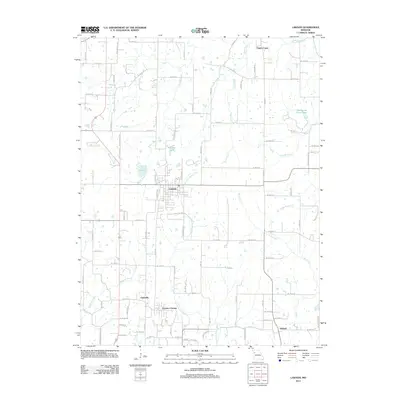
2012 Map of Lawson
USGS Topo · Published 2012About this map
Lawson serves as the primary hub of this north-central Missouri landscape, situated at the crossroads of several regional drainage systems. The town is flanked by the East Fork Fishing River to the east and Brushy Creek to the west, demonstrating a settlement pattern deeply influenced by the area's many bifurcating waterways. Smaller residential clusters like Claysville, Excelsior Estates, and Vibbard are scattered across the southern half of the quadrangle, connected by an extensive grid of local roads and highway routes.
Find a feature on this map
95 named features on this map. Tap any name to fly to it.
Don’t see what you’re looking for? This feature index may not catch every label — zoom into the map to look around manually.
Map Details
Editions of this 2012 Lawson Map
This is the sole edition of this map. No revisions or reprints were ever made.
Other maps of this area

1894 · Independence
USGS Topo · 1:125,000

1924 · Polo
USGS Topo · 1:62,500

1925 · Plattsburg
USGS Topo · 1:62,500

1936 · Kearney
USGS Topo · 1:48,000

1942 · Kearney
USGS Topo · 1:62,500

1945 · Kearney
USGS Topo · 1:62,500

1950 · Kansas City
USGS Topo · 1:250,000

1954 · Kansas City
USGS Topo · 1:250,000

1956 · Kansas City
USGS Topo · 1:250,000
1957 · Knoxville
USGS Topo · 1:24,000