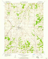
1957 Map of Lawson
USGS Topo · Published 1958About this map
Lawson serves as the central hub of this mid-century survey, situated at the intersection of two major rail lines that defined the local economy and geography. The Chicago Milwaukee St Paul and Pacific and the Atchison Topeka and Santa Fe railroads crisscross the landscape, connecting the town to larger regional markets. Beyond the tracks, the terrain is shaped by the complex drainage of the Fishing River system, including the East Fork Fishing River and Rocky Fork.
Find a feature on this map
24 named features on this map. Tap any name to fly to it.
Don’t see what you’re looking for? This feature index may not catch every label — zoom into the map to look around manually.
Map Details
Editions of this 1957 Lawson Map
2 editions found
Other maps of this area

1894 · Independence
USGS Topo · 1:125,000

1924 · Polo
USGS Topo · 1:62,500

1925 · Plattsburg
USGS Topo · 1:62,500

1936 · Kearney
USGS Topo · 1:48,000

1942 · Kearney
USGS Topo · 1:62,500

1945 · Kearney
USGS Topo · 1:62,500

1950 · Kansas City
USGS Topo · 1:250,000

1954 · Kansas City
USGS Topo · 1:250,000

1956 · Kansas City
USGS Topo · 1:250,000
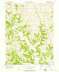
1957 · Knoxville
USGS Topo · 1:24,000