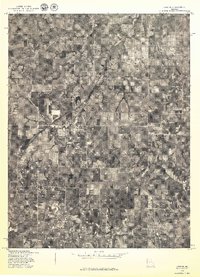
1978 Map of Lawson
USGS Topo · Published 1978About this map
Lawson and its surrounding agricultural landscape are captured in this late-1970s orthophotoquad, which utilizes rectified aerial imagery to show the physical reality of the Missouri countryside. The town of Lawson sits at a primary rail crossing, with the grid of residential streets and the small commercial core clearly visible against the surrounding patchwork of tilled fields and timbered woodlots. Further southeast, the small settlement of Vibbard is situated near the edge of the survey area, connected by a network of rural roads that follow the section lines of the regional survey system. Unlike a traditional topographic map, this imagery-based document, produced by the Geological Survey in cooperation with the Soil Conservation Service, reveals the precise density of forest cover and the exact footprint of farmsteads across Clay County.
Find a feature on this map
2 named features on this map. Tap any name to fly to it.
Don’t see what you’re looking for? This feature index may not catch every label — zoom into the map to look around manually.
Map Details
Editions of this 1978 Lawson Map
This is the sole edition of this map. No revisions or reprints were ever made.
Other maps of this area

1894 · Independence
USGS Topo · 1:125,000

1924 · Polo
USGS Topo · 1:62,500

1925 · Plattsburg
USGS Topo · 1:62,500

1936 · Kearney
USGS Topo · 1:48,000

1942 · Kearney
USGS Topo · 1:62,500

1945 · Kearney
USGS Topo · 1:62,500

1950 · Kansas City
USGS Topo · 1:250,000

1954 · Kansas City
USGS Topo · 1:250,000

1956 · Kansas City
USGS Topo · 1:250,000
1957 · Knoxville
USGS Topo · 1:24,000