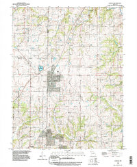
1990 Map of Lawson
USGS Topo · Published 1997About this map
Lawson serves as the primary hub of this north-central Missouri landscape, situated at the junction of Clinton, Ray, and Clay counties. This 1990 revision, based on photography from the late 1940s and subsequent field checks, documents a rural transition as agricultural land meets suburban expansion. To the south, Excelsior Estates and the northern outskirts of Excelsior Springs indicate a shift in settlement density, while the Mobile Home Park near Fishing River provides further evidence of localized residential growth.
Find a feature on this map
19 named features on this map. Tap any name to fly to it.
Don’t see what you’re looking for? This feature index may not catch every label — zoom into the map to look around manually.
Map Details
Editions of this 1990 Lawson Map
This is the sole edition of this map. No revisions or reprints were ever made.
Other maps of this area

1894 · Independence
USGS Topo · 1:125,000

1924 · Polo
USGS Topo · 1:62,500

1925 · Plattsburg
USGS Topo · 1:62,500

1936 · Kearney
USGS Topo · 1:48,000

1942 · Kearney
USGS Topo · 1:62,500

1945 · Kearney
USGS Topo · 1:62,500

1950 · Kansas City
USGS Topo · 1:250,000

1954 · Kansas City
USGS Topo · 1:250,000

1956 · Kansas City
USGS Topo · 1:250,000
1957 · Knoxville
USGS Topo · 1:24,000