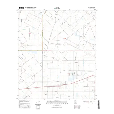
2015 Map of Lawtell
USGS Topo · Published 2015About this map
Lawtell serves as the primary hub for this rural stretch of St. Landry Parish, where the Acadiana landscape is defined by the complex hydrology of the western prairie. The area is intersected by several significant waterways, including Bayou Grand Louis, Bayou Marron, and the W Fork Bayou Plaquemine Brule. These bayous and coulees historically dictated the layout of small farming settlements and road networks. Genealogists will find several burial sites preserved across the landscape, such as Saint Andrews Cem, Pitre Cem, and Bertrand Cem. Small communities like Plaisance and Prairie Ronde reflect the region’s long-standing agricultural character, while Plaquemine Ridge and Veazie sit at the southern edge of the survey area. The intricate grid of parish roads, including many named for local families like Narcisse Lacour Rd and Ophelia Boone Rd, illustrates the enduring connection between the land and its residents into the 21st century.
Find a feature on this map
121 named features on this map. Tap any name to fly to it.
Don’t see what you’re looking for? This feature index may not catch every label — zoom into the map to look around manually.
Map Details
Editions of this 2015 Lawtell Map
This is the sole edition of this map. No revisions or reprints were ever made.
Other maps of this area

1939 · Opelousas
USGS Topo · 1:62,500

1947 · Ville Platte
USGS Topo · 1:31,680

1947 · Chataignier
USGS Topo · 1:31,680

1947 · Pitreville
USGS Topo · 1:31,680

1952 · Lake Charles
USGS Topo · 1:250,000

1954 · Lake Charles
USGS Topo · 1:250,000

1956 · Opelousas
USGS Topo · 1:62,500

1957 · Opelousas
USGS Topo · 1:62,500

1957 · Carencro
USGS Topo · 1:62,500
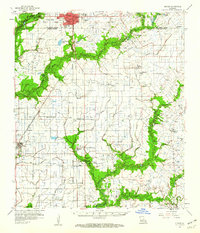
1959 · Eunice
USGS Topo · 1:62,500