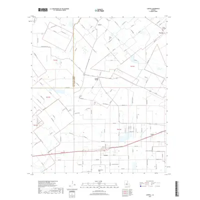
2018 Map of Lawtell
USGS Topo · Published 2018About this map
Lawtell and its surrounding prairie communities anchor this 2018 survey of St. Landry Parish, where the land transitions from the elevated Plaquemine Ridge into a network of slow-moving waterways. The settlement pattern reflects a long history of rural homesteads, with small hamlets like Prairie Ronde, Ledoux, and Veazie connected by a grid of parish roads. Local family heritage is preserved in several burial grounds, including Saint Andrews Cem, Bertrand Cem, and Pitre Cem, which are scattered among the agricultural fields and woodlots.
Find a feature on this map
131 named features on this map. Tap any name to fly to it.
Don’t see what you’re looking for? This feature index may not catch every label — zoom into the map to look around manually.
Map Details
Editions of this 2018 Lawtell Map
This is the sole edition of this map. No revisions or reprints were ever made.
Other maps of this area

1939 · Opelousas
USGS Topo · 1:62,500

1947 · Ville Platte
USGS Topo · 1:31,680

1947 · Chataignier
USGS Topo · 1:31,680

1947 · Pitreville
USGS Topo · 1:31,680

1952 · Lake Charles
USGS Topo · 1:250,000

1954 · Lake Charles
USGS Topo · 1:250,000

1956 · Opelousas
USGS Topo · 1:62,500

1957 · Opelousas
USGS Topo · 1:62,500

1957 · Carencro
USGS Topo · 1:62,500
1959 · Eunice
USGS Topo · 1:62,500