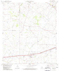
1983 Map of Lawtell
USGS Topo · Published 1983About this map
Lawtell and the surrounding prairies of St. Landry Parish are defined by an intricate network of bayous and a dense cluster of rural institutions during the early 1980s. The landscape is structured around the Missouri Pacific railroad line, which connects the main settlement at Lawtell with Veazie to the east. This area is notable for its high concentration of family-named landmarks and parish infrastructure, including the Pitre Cem and Bertrand Cem, alongside numerous country churches like Sacred Heart Ch and Holy Family Ch. The presence of the Drive-in Theater near Veazie and multiple schools like Lawtell Sch reflects a settled, community-oriented agricultural region. Natural drainage is dictated by winding waterways such as Bayou Mallet and Bayou Plaquemine Brulé, which fragment the rectangular land divisions and influence the placement of early homesteads and cemeteries.
Find a feature on this map
35 named features on this map. Tap any name to fly to it.
Don’t see what you’re looking for? This feature index may not catch every label — zoom into the map to look around manually.
Map Details
Editions of this 1983 Lawtell Map
This is the sole edition of this map. No revisions or reprints were ever made.
Other maps of this area

1939 · Opelousas
USGS Topo · 1:62,500

1947 · Ville Platte
USGS Topo · 1:31,680

1947 · Chataignier
USGS Topo · 1:31,680

1947 · Pitreville
USGS Topo · 1:31,680

1952 · Lake Charles
USGS Topo · 1:250,000

1954 · Lake Charles
USGS Topo · 1:250,000

1956 · Opelousas
USGS Topo · 1:62,500

1957 · Opelousas
USGS Topo · 1:62,500

1957 · Carencro
USGS Topo · 1:62,500
1959 · Eunice
USGS Topo · 1:62,500