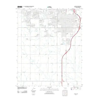
2012 Map of Lawton
USGS Topo · Published 2012About this map
Cameron Univ and Platt Coll stand as prominent academic anchors within the urban grid of Lawton in this early 21st-century portrait. The landscape is defined by its transition from a dense city street plan, which includes historic nodes like the Rock Island Depot, into the open drainage basins of Numu Cr and E Cache Cr. South of the primary residential blocks, the Lawton-Fort Sill Regional Airport and the smaller Neuwirth Airstrip signify the area's long-standing aviation ties.
Find a feature on this map
57 named features on this map. Tap any name to fly to it.
Don’t see what you’re looking for? This feature index may not catch every label — zoom into the map to look around manually.
Map Details
Editions of this 2012 Lawton Map
This is the sole edition of this map. No revisions or reprints were ever made.
Other maps of this area

1937 · Cache
USGS Topo · 1:48,000

1942 · Cache
USGS Topo · 1:62,500

1946 · Lawton
USGS Topo · 1:62,500

1949 · Mount Scott
USGS Topo · 1:24,000

1949 · Arbuckle Hill
USGS Topo · 1:24,000

1949 · Fort Sill
USGS Topo · 1:24,000

1955 · Lawton
USGS Topo · 1:250,000

1956 · Ninemile Creek
USGS Topo · 1:24,000

1956 · Arbuckle Hill
USGS Topo · 1:24,000
1956 · Mount Scott
USGS Topo · 1:24,000