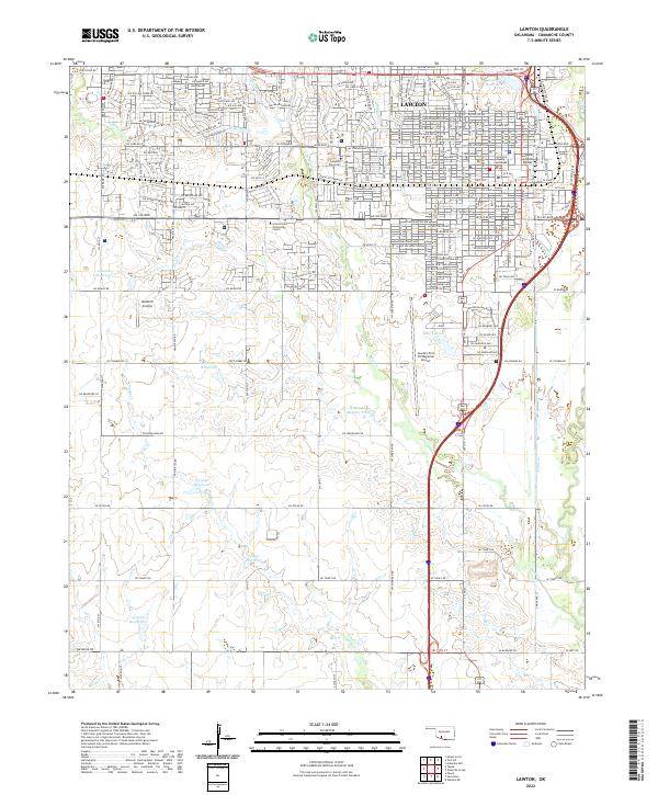
2022 Map of Lawton
USGS Topo · Published 2022About this map
Lawton serves as the focal point of this southwestern Oklahoma landscape, exhibiting a dense residential grid that transitions into the prairie-like terrain of the Great Plains. The city's civic and educational infrastructure is well-defined, featuring the Comanche County Courthouse and institutions such as Cameron University and Platt College. This survey illustrates the area's logistical importance, anchored by the Lawton-Fort Sill Regional Airport and the historic Rock Island Depot rail site. To the south and west, the landscape opens into a series of water management and agricultural features, including the Mercer Minnow Ponds and several numbered reservoirs like 031048 Reservoir. Watercourses such as Numu Creek and East Cache Creek wind through the southeastern portion of the quadrangle, while Wolf Creek and its branches drain the northern suburban reaches. Private aviation is represented by Neuwirth Airstrip, highlighting the spread of decentralized transit across the county.
Find a feature on this map
98 named features on this map. Tap any name to fly to it.
Don’t see what you’re looking for? This feature index may not catch every label — zoom into the map to look around manually.
Map Details
Editions of this 2022 Lawton Map
This is the sole edition of this map. No revisions or reprints were ever made.
Other maps of this area

1937 · Cache
USGS Topo · 1:48,000

1942 · Cache
USGS Topo · 1:62,500

1946 · Lawton
USGS Topo · 1:62,500

1949 · Mount Scott
USGS Topo · 1:24,000

1949 · Arbuckle Hill
USGS Topo · 1:24,000

1949 · Fort Sill
USGS Topo · 1:24,000

1955 · Lawton
USGS Topo · 1:250,000

1956 · Ninemile Creek
USGS Topo · 1:24,000

1956 · Arbuckle Hill
USGS Topo · 1:24,000
1956 · Mount Scott
USGS Topo · 1:24,000