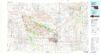
1981 Map of Lawton
USGS Topo · Published 1981About this map
The Fort Sill Military Reservation dominates the landscape north of Lawton, marking a transition between the city’s urban grid and the dramatic elevations of the Wichita Mountains. This 1981 survey illustrates the city’s significant expansion southward and westward toward Lawton Municipal Airport and Cameron University. To the northwest, the Wichita Mountains National Wildlife Refuge preserves a cluster of peaks including Mount Scott, Mount Sheridan, and Mount McKinley, surrounded by significant water features like Lake Lawtonka and Lake Ellsworth. The transportation network is defined by the H.E. Bailey Turnpike and the intersecting lines of the St Louis-San Francisco RR and Chicago Rock Island & Pacific RR, which helped establish regional hubs such as Cache, Apache, and Elgin.
Find a feature on this map
90 named features on this map. Tap any name to fly to it.
Don’t see what you’re looking for? This feature index may not catch every label — zoom into the map to look around manually.
Map Details
Editions of this 1981 Lawton Map
This is the sole edition of this map. No revisions or reprints were ever made.
Other maps of this area

1901 · Addington
USGS Topo · 1:125,000

1902 · Rush Springs
USGS Topo · 1:125,000

1904 · Chickasha
USGS Topo · 1:125,000

1937 · Cache
USGS Topo · 1:48,000

1937 · Quanah Mountain
USGS Topo · 1:24,000

1942 · Cache
USGS Topo · 1:62,500

1945 · Anadarko
USGS Topo · 1:62,500

1946 · Lawton
USGS Topo · 1:62,500

1949 · Mount Scott
USGS Topo · 1:24,000

1949 · Arbuckle Hill
USGS Topo · 1:24,000