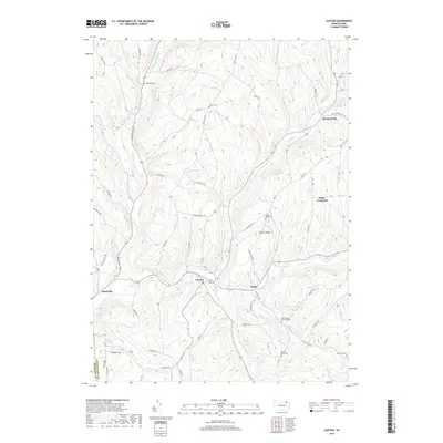
2019 Map of Lawton
USGS Topo · Published 2019About this map
Wyalusing Creek serves as the central geographic corridor for this part of Susquehanna County, where the settlements of Lawton and Rush sit at the confluence of several vital water branches. The landscape is defined by its dendritic drainage system, including the Middle Br Wyalusing Cr and East Branch Wyalusing Creek, which have carved deep valleys between prominent rises like Devine Ridge.
Find a feature on this map
61 named features on this map. Tap any name to fly to it.
Don’t see what you’re looking for? This feature index may not catch every label — zoom into the map to look around manually.
Map Details
Editions of this 2019 Lawton Map
This is the sole edition of this map. No revisions or reprints were ever made.
Other maps of this area

1943 · Montrose
USGS Topo · 1:62,500

1943 · Le Raysville
USGS Topo · 1:62,500

1945 · Montrose
USGS Topo · 1:62,500

1945 · Le Raysville
USGS Topo · 1:62,500

1945 · Meshoppen
USGS Topo · 1:62,500

1945 · Auburn Center
USGS Topo · 1:24,000

1945 · Laceyville
USGS Topo · 1:24,000

1946 · Tunkhannock
USGS Topo · 1:62,500

1946 · Springville
USGS Topo · 1:24,000
1947 · Auburn Center
USGS Topo · 1:31,680
Featured Places
- Rush Township, PA
- Forest Lake Township, PA
- Stevens Township, PA
- Parks Crossroad, Jessup Township
- Birchardville, PA