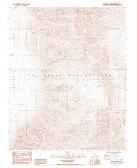
1984 Map of Layton Spring
USGS Topo · Published 1984About this map
Mining operations and remote desert springs define this arid landscape within the Slate Range during the mid-1980s. A significant portion of the terrain is managed as part of the U S Naval Reservation, where the topography is marked by steep canyons and prominent passes. Prospectors and local historians can identify numerous mining sites concentrated in the northern and eastern sections of the quadrangle, including the Virginia Ann Mine, Lake View Mine, and the aptly named Ghost Mine. Water sources were critical for both mining and survival in this environment, evidenced by the presence of Layton Spring, Lone Willow Spring, and Amity Spring. The map also reveals the industrial infrastructure of the era, such as Deans Mill, located near the floor of the Searles Valley.
Find a feature on this map
22 named features on this map. Tap any name to fly to it.
Don’t see what you’re looking for? This feature index may not catch every label — zoom into the map to look around manually.
Map Details
Editions of this 1984 Layton Spring Map
This is the sole edition of this map. No revisions or reprints were ever made.
Other maps of this area

1915 · Searles Lake
USGS Topo · 1:250,000

1947 · Trona
USGS Topo · 1:250,000

1948 · Trona
USGS Topo · 1:250,000

1949 · Trona
USGS Topo · 1:62,500

1949 · Searles Lake
USGS Topo · 1:62,500

1950 · Searles Lake
USGS Topo · 1:62,500

1950 · Trona
USGS Topo · 1:62,500

1950 · Manly Peak
USGS Topo · 1:62,500

1950 · Wingate Pass
USGS Topo · 1:62,500

1951 · Wingate Pass
USGS Topo · 1:62,500