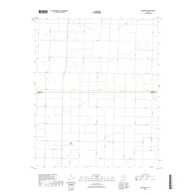
2019 Map of Lazbuddie SW
USGS Topo · Published 2019About this map
The Parmer and Bailey County line bisects this agricultural landscape in the Texas Panhandle, where a rigid grid of rural roads facilitates local transport. Locker Brothers Airport serves as a distinct landmark in the southern half of the quadrangle, reflecting the importance of private aviation in managing these large agricultural holdings. The map detail is dominated by local infrastructure, including state-designated routes like Fm 3269 and an extensive network of county roads such as Co Rd Aa and Co Rd 1008. This 2019 survey shows the area's modern land-use patterns, primarily characterized by large-scale farming and ranching operations that have long defined this portion of the South Plains.
Find a feature on this map
31 named features on this map. Tap any name to fly to it.
Don’t see what you’re looking for? This feature index may not catch every label — zoom into the map to look around manually.
Map Details
Editions of this 2019 Lazbuddie SW Map
This is the sole edition of this map. No revisions or reprints were ever made.
Other maps of this area

1954 · Clovis
USGS Topo · 1:250,000

1958 · Clovis
USGS Topo · 1:250,000

1962 · Muleshoe
USGS Topo · 1:24,000

1962 · Baileyboro NE
USGS Topo · 1:24,000

1962 · Muleshoe NE
USGS Topo · 1:24,000

1963 · Clays Corner
USGS Topo · 1:24,000

1963 · Lazbuddie
USGS Topo · 1:24,000

1963 · Lariat NE
USGS Topo · 1:24,000

1963 · Lazbuddie SW
USGS Topo · 1:24,000

1963 · Progress
USGS Topo · 1:24,000