
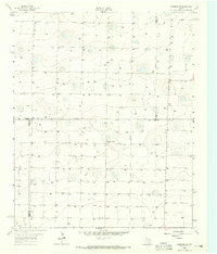
1963 Map of Lazbuddie SW
USGS Topo · Published 1965About this map
Deep agricultural infrastructure and water management define this High Plains landscape along the boundary of Parmer Co and Bailey Co. The 1963 survey reveals a meticulously gridded territory dominated by an extensive network of irrigation wells, such as Well 3978 and Well 3964, which were essential to the region's mid-century cotton and grain production. These numbered water sources reflect the industrialization of the Ogallala Aquifer's resources during a period of rapid development in the Texas Panhandle.
Find a feature on this map
151 named features on this map. Tap any name to fly to it.
Don’t see what you’re looking for? This feature index may not catch every label — zoom into the map to look around manually.
Map Details
Editions of this 1963 Lazbuddie SW Map
This is the sole edition of this map. No revisions or reprints were ever made.
Other maps of this area

1954 · Clovis
USGS Topo · 1:250,000

1958 · Clovis
USGS Topo · 1:250,000

1962 · Muleshoe
USGS Topo · 1:24,000

1962 · Baileyboro NE
USGS Topo · 1:24,000

1962 · Muleshoe NE
USGS Topo · 1:24,000

1963 · Clays Corner
USGS Topo · 1:24,000

1963 · Lazbuddie
USGS Topo · 1:24,000

1963 · Lariat NE
USGS Topo · 1:24,000

1963 · Progress
USGS Topo · 1:24,000
1963 · Lazbuddie SE
USGS Topo · 1:24,000