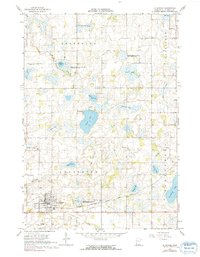
1966 Map of Le Center
USGS Topo · Published 1991About this map
Le Center serves as the primary hub in this mid-1960s survey, showing a well-defined grid that includes essential community landmarks like St Marys Cem and a Sewage Disposal plant. The surrounding landscape is defined by the recession of glacial ice, leaving behind a dense network of water bodies such as Clear Lake, Mary Lake, and Harkridge Lake. Many of these areas are preserved as state lands, including the Sautter State Wildlife Management Area and the Bardel State Wildlife Management Area.
Find a feature on this map
32 named features on this map. Tap any name to fly to it.
Don’t see what you’re looking for? This feature index may not catch every label — zoom into the map to look around manually.
Map Details
Editions of this 1966 Le Center Map
2 editions found
Other maps of this area

1953 · Saint Paul
USGS Topo · 1:250,000

1957 · Belle Plaine
USGS Topo · 1:62,500

1957 · New Prague
USGS Topo · 1:62,500

1959 · Saint Paul
USGS Topo · 1:250,000

1965 · Cleveland
USGS Topo · 1:24,000

1965 · St Thomas
USGS Topo · 1:24,000

1966 · Montgomery
USGS Topo · 1:24,000

1966 · Cordova
USGS Topo · 1:24,000

1966 · Le Center
USGS Topo · 1:24,000
1966 · Kilkenny
USGS Topo · 1:24,000