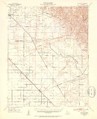
1946 Map of Le Grand
USGS Topo · Published 1953About this map
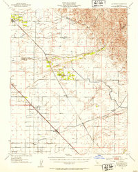
Agricultural development in the San Joaquin Valley is defined by a dense network of sloughs and man-made infrastructure in this mid-century survey. The landscape is anchored by the Atchison Topeka and Santa Fe and Southern Pacific railroads, which facilitated the growth of shipping points like Le Grand and Chowchilla. While the foothills of the Sierra Nevada rise in the northeast near the Merced and Madera County line, the valley floor is characterized by an intricate drainage system including the Chowchilla River, Ash Slough, and Berenda Slough. Rural life is centered around local institutions such as the Dixieland School and small settlements like Fairmead and Sharon. The mapping reflects a transition from early 20th-century topography to post-war land use, with numerous Windmills and a developing network of county thoroughfares like Jefferson Road and Buchanan Hollow Road supporting the region's expanding farm economy.
Find a feature on this map
38 named features on this map. Tap any name to fly to it.
Don’t see what you’re looking for? This feature index may not catch every label — zoom into the map to look around manually.
Map Details
Editions of this 1946 Le Grand Map
2 editions found
Other maps of this area

1912 · Mariposa
USGS Topo · 1:125,000

1915 · Owens Creek
USGS Topo · 1:31,680

1916 · Berenda
USGS Topo · 1:31,680

1918 · Owens Creek
USGS Topo · 1:31,680

1918 · Chowchilla
USGS Topo · 1:31,680

1918 · Berenda
USGS Topo · 1:31,680

1918 · Planada
USGS Topo · 1:31,680

1918 · La Grand
USGS Topo · 1:31,680

1919 · Indian Gulch
USGS Topo · 1:48,000

1919 · Plainsberg
USGS Topo · 1:31,680