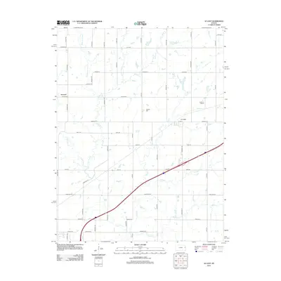
2012 Map of Le Loup
USGS Topo · Published 2012About this map
The community of Le Loup and the nearby settlement of Norwood anchor this survey of eastern Kansas, where a dense grid of rural routes like Oregon Rd and Tennessee Rd facilitates local commerce. The landscape is defined by the winding tributaries of Tauy Cr, including the Middle Fork, East Fork, and West Fork. These waterways, along with Wolf Cr and Walnut Cr, carve through the agricultural terrain, punctuated by the elevation of Fowler Hill. A significant transportation corridor, Interstate 35, cuts diagonally across the southern half of the quadrangle, reflecting the region's role in modern connectivity. The presence of Coffman Airport north of Le Loup further highlights the integration of traditional farming lands with contemporary infrastructure. This document provides a clear view of the drainage patterns and road networks that have shaped the development of Franklin County.
Find a feature on this map
47 named features on this map. Tap any name to fly to it.
Don’t see what you’re looking for? This feature index may not catch every label — zoom into the map to look around manually.
Map Details
Editions of this 2012 Le Loup Map
This is the sole edition of this map. No revisions or reprints were ever made.
Other maps of this area

1885 · Lawrence
USGS Topo · 1:125,000

1889 · Lawrence
USGS Topo · 1:125,000

1947 · Lawrence
USGS Topo · 1:250,000

1950 · Lawrence
USGS Topo · 1:250,000

1956 · Wellsville
USGS Topo · 1:24,000

1956 · Ottawa North
USGS Topo · 1:24,000

1956 · Le Loup
USGS Topo · 1:24,000

1956 · Ottawa South
USGS Topo · 1:24,000
1956 · Edgerton
USGS Topo · 1:24,000

1956 · Lawrence
USGS Topo · 1:250,000