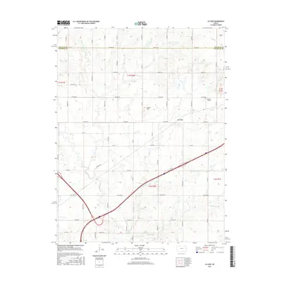
2015 Map of Le Loup
USGS Topo · Published 2015About this map
The settlement of Le Loup and its surrounding agricultural landscape dominate this eastern Kansas survey, which captures the area as it transitioned into the early 21st century. Situated along the border of Douglas Co and Franklin Co, the region is defined by a dense network of sectional roads including Woodson Rd and Ohio Rd. The drainage patterns of the Tauy Creek watershed, specifically the winding paths of Middle Fork Tauy Cr and E Fork Tauy Cr, create a rolling topography punctuated by prominent landmarks such as Fowler Hill. The infrastructure includes Coffman Airport, reflecting the local aviation history of the Ottawa vicinity. This survey provides a precise look at the land division and water resources, tracing the numerous tributaries like Spring Cr and Wolf Cr that shaped the settlement patterns and agricultural development of the Kansas plains.
Find a feature on this map
46 named features on this map. Tap any name to fly to it.
Don’t see what you’re looking for? This feature index may not catch every label — zoom into the map to look around manually.
Map Details
Editions of this 2015 Le Loup Map
This is the sole edition of this map. No revisions or reprints were ever made.
Other maps of this area

1885 · Lawrence
USGS Topo · 1:125,000

1889 · Lawrence
USGS Topo · 1:125,000

1947 · Lawrence
USGS Topo · 1:250,000

1950 · Lawrence
USGS Topo · 1:250,000

1956 · Wellsville
USGS Topo · 1:24,000

1956 · Ottawa North
USGS Topo · 1:24,000

1956 · Le Loup
USGS Topo · 1:24,000

1956 · Ottawa South
USGS Topo · 1:24,000
1956 · Edgerton
USGS Topo · 1:24,000

1956 · Lawrence
USGS Topo · 1:250,000