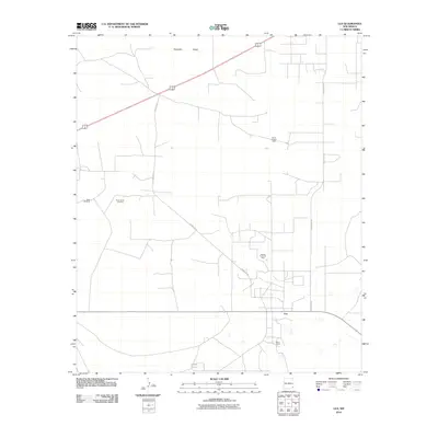
2010 Map of Lea
USGS Topo · Published 2010About this map
The Querecho Plains of southeastern New Mexico serve as the backdrop for this study of petroleum extraction and rural infrastructure. The landscape is defined by a dense network of service roads and oil fields, most notably the North Lynch Oil Field, the Lea Oil and Gas Field, and the Middle Lynch Oil Field. These industrial zones are interspersed with markers of ranching life, such as the West Windmill and South Tank. The small settlement of Lea and the nearby Berry Ranch anchor the southern portion of the map, connected to the wider region by County Rd 27 and Marathon Rd. This survey documents the intersection of traditional land use and the modern energy economy in the High Plains.
Find a feature on this map
10 named features on this map. Tap any name to fly to it.
Don’t see what you’re looking for? This feature index may not catch every label — zoom into the map to look around manually.
Map Details
Editions of this 2010 Lea Map
This is the sole edition of this map. No revisions or reprints were ever made.
Other maps of this area

1954 · Hobbs
USGS Topo · 1:250,000

1958 · Hobbs
USGS Topo · 1:250,000

1963 · Oil Center
USGS Topo · 1:62,500

1963 · Monument
USGS Topo · 1:62,500

1963 · Laguna Gatuna
USGS Topo · 1:62,500

1963 · Hat Mesa
USGS Topo · 1:62,500

1978 · Jal
USGS Topo · 1:100,000

1984 · Lea
USGS Topo · 1:24,000

1984 · Ironhouse Well
USGS Topo · 1:24,000
1984 · Grama Ridge
USGS Topo · 1:24,000