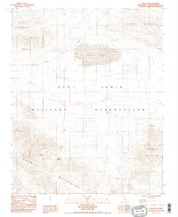
1985 Map of Leach Lake
USGS Topo · Published 1985About this map
The Fort Irwin Military Reservation dominates this 1985 landscape, reflecting its importance as a high-desert training ground. At its heart lies the dry bed of Leach Lake, which serves as a focal point for aviation and ballistic activities, evidenced by the Target Airfield and various marked targets scattered across the basin. This mid-1980s survey captures a transition in the Mojave desert where traditional mining and ranching infrastructure met modern military utility.
Find a feature on this map
11 named features on this map. Tap any name to fly to it.
Don’t see what you’re looking for? This feature index may not catch every label — zoom into the map to look around manually.
Map Details
Editions of this 1985 Leach Lake Map
2 editions found
Other maps of this area

1933 · Avawatz Mountains
USGS Topo · 1:250,000

1947 · Trona
USGS Topo · 1:250,000

1948 · Trona
USGS Topo · 1:250,000

1948 · Quail Mountains
USGS Topo · 1:62,500

1948 · Leach Lake
USGS Topo · 1:62,500

1948 · Goldstone Lake
USGS Topo · 1:62,500

1948 · Tiefort Mountains
USGS Topo · 1:62,500

1951 · Goldstone Lake
USGS Topo · 1:62,500

1951 · Tiefort Mountains
USGS Topo · 1:62,500

1951 · Quail Mountains
USGS Topo · 1:62,500