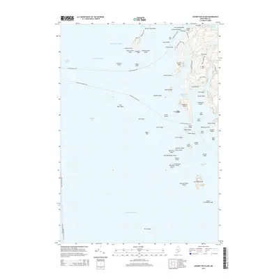
2014 Map of Leadbetter Island
USGS Topo · Published 2014About this map
The waters of Penobscot Bay and the Atlantic Ocean define this coastal landscape, where a dense archipelago is tied together by essential maritime routes. Vital ferry lines, including the N Haven-Rockland Fry and the Rockland-Vinalhaven Fry, navigate through hazards like Drunkard Ledge and Fiddler Ledge to reach the island communities. The terrain is marked by distinctive elevations such as Tiptoe Mtn and Mid Mtn, which overlook sheltered waters like Crockett Cove and the Leadbetter Narrows. Historically significant landmarks, such as Browns Head and the isolated Hurricane Island, anchor this survey of Knox County's seafaring geography. From the Narrow Place Beach at the north to the southern reaches of James and Willies Ledge, the map documents the complex relationship between these rocky outposts and the working waterfronts of the Maine coast.
Find a feature on this map
70 named features on this map. Tap any name to fly to it.
Don’t see what you’re looking for? This feature index may not catch every label — zoom into the map to look around manually.
Map Details
Editions of this 2014 Leadbetter Island Map
This is the sole edition of this map. No revisions or reprints were ever made.
Other maps of this area

1904 · Vinalhaven
USGS Topo · 1:62,500

1904 · Tenants Harbor
USGS Topo · 1:62,500

1904 · Rockland
USGS Topo · 1:62,500

1905 · Penobscot Bay
USGS Topo · 1:125,000

1906 · Matinicus
USGS Topo · 1:62,500

1906 · Tennant Harbor
USGS Topo · 1:62,500

1906 · Rockland
USGS Topo · 1:62,500

1941 · Rockland
USGS Topo · 1:62,500

1941 · Vinalhaven
USGS Topo · 1:62,500

1944 · Vinalhaven
USGS Topo · 1:62,500