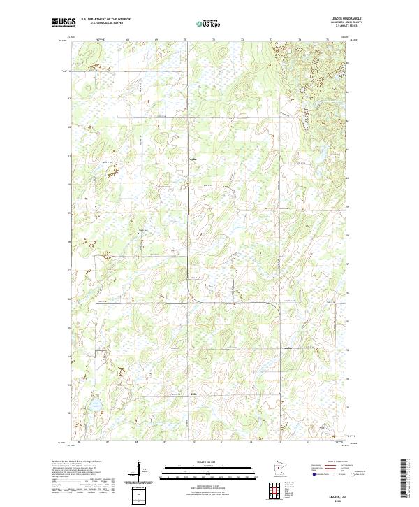
2022 Map of Leader
USGS Topo · Published 2022About this map
Poplar, Leader, and Ellis serve as the primary anchors for this rural Cass County landscape, where small crossroads settlements dot a terrain defined by extensive wetlands and meandering watercourses. The local history of the region is grounded at the Poplar Cem, situated near the headwaters of Martin Cr. The hydrology of the area is particularly complex, with Tower Cr and Swan Cr draining into a network of marshes and basins, including Hardwood Lake in the northeast and Mud Lake in the southwest. A rigid grid of section-line roads, such as 83rd Ave SW and Co Rd 106, provides the only structural framework across the shifting saturated soils and creek bottoms. This layout reflects the late-stage development of central Minnesota's timber and agricultural lands, where the natural flow of Little Swan Cr and Iron Cr often dictates the placement of the few remaining rural tracks.
Find a feature on this map
36 named features on this map. Tap any name to fly to it.
Don’t see what you’re looking for? This feature index may not catch every label — zoom into the map to look around manually.
Map Details
Editions of this 2022 Leader Map
This is the sole edition of this map. No revisions or reprints were ever made.
Other maps of this area

1919 · Leader
USGS Topo · 1:62,500

1953 · Brainerd
USGS Topo · 1:250,000

1957 · Brainerd
USGS Topo · 1:250,000

1958 · Brainerd
USGS Topo · 1:250,000

1965 · Brainerd
USGS Topo · 1:250,000

1966 · Staples NE
USGS Topo · 1:24,000
1966 · Casino
USGS Topo · 1:24,000
1966 · Motley NW
USGS Topo · 1:24,000

1969 · Burgen Lake
USGS Topo · 1:24,000
1969 · Oylen
USGS Topo · 1:24,000