
1919 Map of Leader
USGS Topo · Published 1943About this map
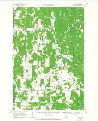
Spider Lake and the meandering headwaters of the Pine River dominate this 1919 progressive military survey of Cass County. The landscape is defined by an extensive network of drainage infrastructure, including the Farnham Ditch and numerous unnamed ditches that crisscross the townships of Ansel, Bungo, and Poplar. These engineering efforts highlight a period of intensive land reclamation and wetland management in northern Minnesota. Small rural hubs such as Leader and Popler are situated along early roads, often anchored by a local school and positioned near the intersections of the 4th Guide Meridian and the 9th Standard Parallel North. The map also traces the South Branch Pine River and Swan Creek, illustrating the natural drainage system that influenced the placement of early settlements like Ellis and Graff.
Find a feature on this map
31 named features on this map. Tap any name to fly to it.
Don’t see what you’re looking for? This feature index may not catch every label — zoom into the map to look around manually.
Map Details
Editions of this 1919 Leader Map
This is the sole edition of this map. No revisions or reprints were ever made.
Other maps of this area

1916 · Pillager
USGS Topo · 1:62,500

1919 · Pillager
USGS Topo · 1:62,500

1953 · Brainerd
USGS Topo · 1:250,000

1957 · Brainerd
USGS Topo · 1:250,000

1958 · Brainerd
USGS Topo · 1:250,000

1959 · Pine River
USGS Topo · 1:24,000

1959 · Pine River SW
USGS Topo · 1:24,000

1965 · Brainerd
USGS Topo · 1:250,000

1966 · Staples NE
USGS Topo · 1:24,000
1966 · Casino
USGS Topo · 1:24,000