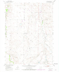
1951 Map of Leader SE
USGS Topo · Published 1979About this map
East Bijou Creek and West Bijou Creek dominate the western edge of this Colorado high plains landscape, illustrating a classic drainage pattern of the Missouri River Basin. The 1951 surveys captured a sparsely populated ranching and farming area where water sources and elevation dictated the layout of homesteads and essential community hubs. Rural life is anchored by landmarks like the Busy Bee School (Aband) and the Woolsey Cem, which served the small clusters of residents at Clearview and Perry.
Find a feature on this map
15 named features on this map. Tap any name to fly to it.
Don’t see what you’re looking for? This feature index may not catch every label — zoom into the map to look around manually.
Map Details
Editions of this 1951 Leader SE Map
5 editions found
Other maps of this area

1951 · Leader NW
USGS Topo · 1:24,000

1951 · Leader SE
USGS Topo · 1:24,000

1951 · Leader
USGS Topo · 1:24,000

1952 · Leader SW
USGS Topo · 1:24,000

1953 · Denver
USGS Topo · 1:250,000

1954 · Limon
USGS Topo · 1:250,000

1956 · Peoria
USGS Topo · 1:24,000

1956 · Byers
USGS Topo · 1:24,000

1957 · Denver
USGS Topo · 1:250,000

1957 · Limon
USGS Topo · 1:250,000