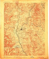
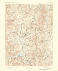
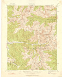
1891 Map of Leadville
USGS Topo · Published 1901About this map
The high-altitude mining district surrounding Leadville dominates this late-nineteenth-century reconnaissance survey, capturing a landscape transformed by the silver boom. The network of competing railroads, including the Denver and Rio Grande Railroad, the Union Pacific Railroad, and the Colorado Midland Railway, reveals the intense industrial pressure of the era. These lines climb through steep passes like Fremont Pass and Tennessee Pass to reach specialized settlements and mineral hubs. To the east, the map details the early development of Breckenridge and the small mining camps of Kokomo and Robinson along the East Fork Eagle River. Prominent peaks like Mt of the Holy Cross and Mt Elbert define the horizon, while smaller mining sites such as Oro and Dudley illustrate the dense settlement pattern of the central Rockies during their primary extractive age.
Find a feature on this map
157 named features on this map. Tap any name to fly to it.
Don’t see what you’re looking for? This feature index may not catch every label — zoom into the map to look around manually.
Map Details
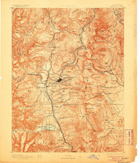
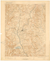
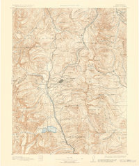
Editions of this 1891 Leadville Map
7 editions found
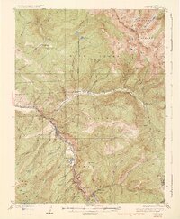
Other maps of this area

1889 · Leadville
USGS Topo · 1:125,000

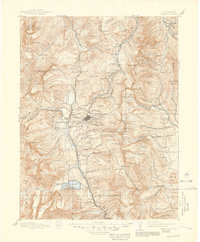
1891 · Leadville
USGS Topo · 1:125,000

1909 · Mount Jackson
USGS Topo · 1:125,000

1911 · Mount Jackson
USGS Topo · 1:125,000
1924 · Montezuma
USGS Topo · 1:62,500

1926 · Montezuma
USGS Topo · 1:62,500
1929 · Dillon
USGS Topo · 1:62,500
1933 · Montezuma
USGS Topo · 1:62,500

1934 · Climax
USGS Topo · 1:48,000
1934 · Minturn
USGS Topo · 1:62,500