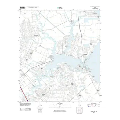
2010 Map of League City
USGS Topo · Published 2010About this map
League City and its surrounding coastal communities anchor this 2010 study of the western shore of Galveston Bay. The map reveals a dense network of suburban development and maritime infrastructure, with numerous marinas such as South Shore Harbour Marina and Seabrook Shipyard Marina lining the complex inlets of Clear Lake. This era shows the continued integration of space-age institutional presence with residential growth, evidenced by the Lunar and Planetary Institute Rice University situated near Nassau Bay.
Find a feature on this map
97 named features on this map. Tap any name to fly to it.
Don’t see what you’re looking for? This feature index may not catch every label — zoom into the map to look around manually.
Map Details
Editions of this 2010 League City Map
This is the sole edition of this map. No revisions or reprints were ever made.
Other maps of this area

1915 · Deepwater
USGS Topo · 1:24,000

1916 · Genoa
USGS Topo · 1:24,000

1916 · Morgan Point
USGS Topo · 1:24,000

1916 · Seabrook
USGS Topo · 1:24,000

1916 · La Porte
USGS Topo · 1:24,000

1919 · Morgan Point
USGS Topo · 1:31,680

1919 · Deepwater
USGS Topo · 1:31,680

1920 · Seabrook
USGS Topo · 1:31,680

1920 · Genoa
USGS Topo · 1:31,680

1920 · La Porte
USGS Topo · 1:31,680