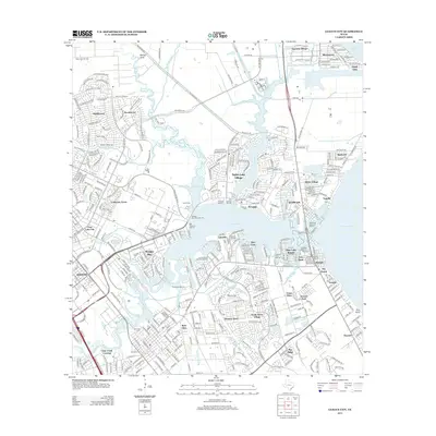
2013 Map of League City
USGS Topo · Published 2013About this map
Galveston Bay and its intricate network of inlets define this coastal landscape on the edge of the Houston metropolitan area. The 2013 survey illustrates the dense concentration of maritime infrastructure, featuring numerous facilities such as the Seabrook Shipyard Marina, South Shore Harbour Marina, and the Lafayette Landing Marina. The map records a complex suburban and nautical environment where residential communities like Taylor Lake Village and El Lago are built around water bodies like Taylor Lake and Mud Lake.
Find a feature on this map
71 named features on this map. Tap any name to fly to it.
Don’t see what you’re looking for? This feature index may not catch every label — zoom into the map to look around manually.
Map Details
Editions of this 2013 League City Map
This is the sole edition of this map. No revisions or reprints were ever made.
Other maps of this area

1915 · Deepwater
USGS Topo · 1:24,000

1916 · Genoa
USGS Topo · 1:24,000

1916 · Morgan Point
USGS Topo · 1:24,000

1916 · Seabrook
USGS Topo · 1:24,000

1916 · La Porte
USGS Topo · 1:24,000

1919 · Morgan Point
USGS Topo · 1:31,680

1919 · Deepwater
USGS Topo · 1:31,680

1920 · Seabrook
USGS Topo · 1:31,680

1920 · Genoa
USGS Topo · 1:31,680

1920 · La Porte
USGS Topo · 1:31,680