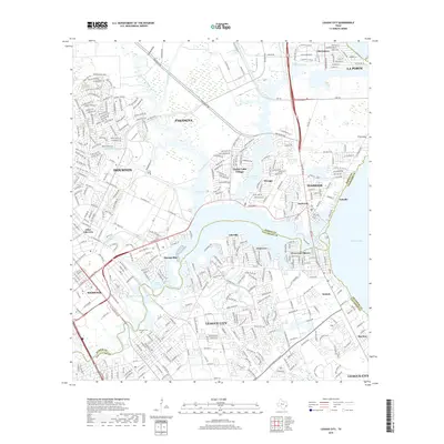
2019 Map of League City
USGS Topo · Published 2019About this map
League City and its neighboring waterfront communities define this late-2010s landscape where Harris, Galveston, and Chambers counties meet. The map reveals an intricate network of residential subdivisions and commercial corridors woven around the vital waterways of Armand Bayou, Taylor Lake, and the northern reaches of Galveston Bay. The influence of the aerospace industry is geographically anchored by Nasa Road 1, which connects Nassau Bay and Webster to the coastal settlements. Genealogists and local historians can locate the Fairview Cem near the heart of the city, while the shoreline details of Seabrook, Kemah, and Todville illustrate the dense modern development of the Texas Gulf Coast. This edition documents the complex hydrography of the region, including Clear Creek and numerous small inlets like Jarbo Bayou that have shaped the growth of these suburban centers.
Find a feature on this map
45 named features on this map. Tap any name to fly to it.
Don’t see what you’re looking for? This feature index may not catch every label — zoom into the map to look around manually.
Map Details
Editions of this 2019 League City Map
This is the sole edition of this map. No revisions or reprints were ever made.
Other maps of this area

1915 · Deepwater
USGS Topo · 1:24,000

1916 · Genoa
USGS Topo · 1:24,000

1916 · Morgan Point
USGS Topo · 1:24,000

1916 · Seabrook
USGS Topo · 1:24,000

1916 · La Porte
USGS Topo · 1:24,000

1919 · Morgan Point
USGS Topo · 1:31,680

1919 · Deepwater
USGS Topo · 1:31,680

1920 · Seabrook
USGS Topo · 1:31,680

1920 · Genoa
USGS Topo · 1:31,680

1920 · La Porte
USGS Topo · 1:31,680