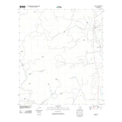
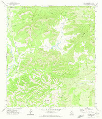
2010 Map of Leakey
USGS Topo · Published 2010About this map
Leakey stands as the primary settlement on this Texas Hill Country landscape, situated near the headwaters of the Frio River. The terrain is defined by a dense network of drainages and named hollows, reflecting a rugged topography where small-scale ranching and seasonal waterways like Dry Frio River and Patterson Creek dictate the layout of roads and property lines. Notable local features include the Alto Frio Encampment and several smaller landmarks such as Leakey Springs. For those tracing local families, the presence of the Exile Cemetery and Clark Cemetery provides specific points of interest for genealogical research. The road system, including routes like Ranch Rd 337 and Ranch Rd 336, winds around natural features like Cedar Hollow and Tucker Hollow, illustrating how the community has integrated with the canyon and creek geography over generations.
Find a feature on this map
49 named features on this map. Tap any name to fly to it.
Don’t see what you’re looking for? This feature index may not catch every label — zoom into the map to look around manually.
Map Details
Editions of this 2010 Leakey Map
This is the sole edition of this map. No revisions or reprints were ever made.
Other maps of this area

1954 · San Antonio
USGS Topo · 1:250,000

1956 · Utopia
USGS Topo · 1:62,500

1957 · San Antonio
USGS Topo · 1:250,000

1957 · York Hollow
USGS Topo · 1:62,500

1960 · Magers Crossing
USGS Topo · 1:24,000

1964 · Circle Bluff
USGS Topo · 1:24,000
1969 · Rio Frio
USGS Topo · 1:24,000
1971 · Leakey
USGS Topo · 1:24,000
1971 · Owl Hollow
USGS Topo · 1:24,000
1971 · Lake Creek
USGS Topo · 1:24,000