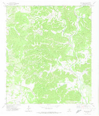
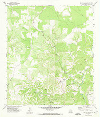
1971 Map of Owl Hollow
USGS Topo · Published 1974About this map
The West Frio River carves a distinct path through the limestone-cut landscape of Real County in the early 1970s. This survey, based on 1970 aerial photography, reveals a remote ranching territory defined by an intricate network of drainages such as Plum Hollow, Bullhead Creek, and Owl Hollow. The presence of a Landing Strip near the river bend and Gravel Pits to the south suggests the localized infrastructure required for managing these large Hill Country tracts. The landscape is dominated by steep relief and numerous springs feeding into narrow valleys like Rain Valley, illustrating the rugged topography that dictated settlement patterns and land use in this part of Texas. While the map is light on formal townsites, it provides an exacting record of the seasonal watercourses and hollows, including North Cedar Creek and South Cedar Creek, which have long served as landmarks for local landowners.
Find a feature on this map
19 named features on this map. Tap any name to fly to it.
Don’t see what you’re looking for? This feature index may not catch every label — zoom into the map to look around manually.
Map Details
Editions of this 1971 Owl Hollow Map
This is the sole edition of this map. No revisions or reprints were ever made.
Other maps of this area

1954 · San Antonio
USGS Topo · 1:250,000

1956 · Utopia
USGS Topo · 1:62,500

1957 · San Antonio
USGS Topo · 1:250,000

1957 · York Hollow
USGS Topo · 1:62,500

1964 · Hillcrest Ranch
USGS Topo · 1:24,000

1964 · Circle Bluff
USGS Topo · 1:24,000
1969 · Rio Frio
USGS Topo · 1:24,000
1971 · Leakey
USGS Topo · 1:24,000
1971 · Joy Hollow
USGS Topo · 1:24,000
1971 · Bee Cave Hollow
USGS Topo · 1:24,000