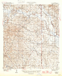
1943 Map of Leander
USGS Topo · Published 1947About this map
Fullerton and East Fullerton stand at the southern edge of this mid-century survey, centered on the lumber and rail operations of the Kisatchie National Forest. The landscape is defined by the winding Calcasieu River and an extensive network of industrial transportation, including the Louisiana And Gulf Railroad and several unnamed Logging Railroad spurs. These routes, along with an Old Logging Grade and the Military Grade, suggest a region transitioning from active timber harvesting to more established rural settlements.
Find a feature on this map
66 named features on this map. Tap any name to fly to it.
Don’t see what you’re looking for? This feature index may not catch every label — zoom into the map to look around manually.
Map Details
Editions of this 1943 Leander Map
2 editions found
Other maps of this area

1932 · Boyce SW
USGS Topo · 1:31,680

1935 · Pawnee
USGS Topo · 1:31,680

1937 · Chopin SW
USGS Topo · 1:31,680

1937 · Chopin SE
USGS Topo · 1:31,680

1941 · Slagle
USGS Topo · 1:62,500

1941 · Boyce
USGS Topo · 1:62,500

1942 · Kisatchie
USGS Topo · 1:62,500

1942 · Oakdale
USGS Topo · 1:62,500

1943 · Leander
USGS Topo · 1:62,500

1943 · Kisatchie
USGS Topo · 1:62,500