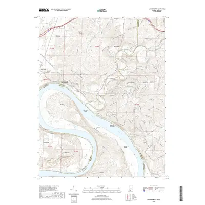
2019 Map of Leavenworth
USGS Topo · Published 2019About this map
The Ohio River carves a dramatic path through this southern Indiana landscape, defining the borders between Crawford, Harrison, and Meade counties. The settlement of Leavenworth occupies a high bench above the river, while the town of Wyandotte serves as a gateway to an extensive network of recreation paths, including the Wyandotte Cave Trail and the Adventure Hiking Trail. The river's influence is evident in the named bottomlands and bends, such as Round Bottom, Oxbow Bend, and Paradise Bottom, which have long dictated the agricultural and transit patterns of the region.
Find a feature on this map
110 named features on this map. Tap any name to fly to it.
Don’t see what you’re looking for? This feature index may not catch every label — zoom into the map to look around manually.
Map Details
Editions of this 2019 Leavenworth Map
This is the sole edition of this map. No revisions or reprints were ever made.
Other maps of this area

1931 · Corydon
USGS Topo · 1:62,500

1944 · Corydon West
USGS Topo · 1:24,000

1946 · Leavenworth
USGS Topo · 1:24,000

1946 · Depauw
USGS Topo · 1:24,000

1947 · Leavenworth
USGS Topo · 1:24,000

1947 · Corydon West
USGS Topo · 1:24,000

1947 · Mauckport
USGS Topo · 1:24,000

1948 · Milltown
USGS Topo · 1:24,000

1950 · Beechwood
USGS Topo · 1:24,000

1950 · English
USGS Topo · 1:24,000