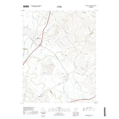
2019 Map of Lebanon Junction
USGS Topo · Published 2019About this map
Lebanon Junction and Boston anchor this 2019 survey, illustrating the modern intersection of transit and topography where Bullitt, Nelson, and Hardin counties meet. The landscape is defined by the winding paths of Rolling Fork and Beech Fork, which navigate around the prominent Hurricane Hills and Keith Knob. This map serves as an excellent reference for local historians tracing family names in the rural Kentucky countryside, with locations like Mount Moriah Cem and Little Brick Cem clearly marked among the hollows.
Find a feature on this map
91 named features on this map. Tap any name to fly to it.
Don’t see what you’re looking for? This feature index may not catch every label — zoom into the map to look around manually.
Map Details
Editions of this 2019 Lebanon Junction Map
This is the sole edition of this map. No revisions or reprints were ever made.
Other maps of this area

1935 · Elizabethtown
USGS Topo · 1:48,000

1936 · Vine Grove
USGS Topo · 1:62,500

1938 · Elizabethtown
USGS Topo · 1:62,500

1943 · Vine Grove
USGS Topo · 1:62,500

1946 · Pitts Point
USGS Topo · 1:24,000

1946 · Colesburg
USGS Topo · 1:24,000

1946 · Vine Grove
USGS Topo · 1:62,500

1949 · Cravens
USGS Topo · 1:24,000

1949 · Elizabethtown
USGS Topo · 1:24,000

1949 · Shepherdsville
USGS Topo · 1:24,000