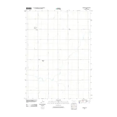
2010 Map of Lebanon
USGS Topo · Published 2010About this map
Lebanon and Highland Park are the primary points of settlement in this rural Sioux County landscape, where the grid of sections is meticulously defined by a network of local roads including Dogwood Ave and Eagle Ave. The community's social and historical fabric is anchored by its religious and commemorative sites, such as the Lebaron Christian Reform Church and the adjacent Lebaron Christian Cemetery. Further east, the Peace Lutheran Cemetery serves as another quiet landmark within the agricultural expanse. The drainage patterns of the area are characterized by the meandering courses of Sixmile Creek and Dry Creek, which cut across the structured township lines. For genealogists, the inclusion of Highland Cemetery provides a specific point of interest for tracing early families in this corner of Iowa, illustrating a landscape where the placement of cemeteries and churches has long organized the rural population.
Find a feature on this map
24 named features on this map. Tap any name to fly to it.
Don’t see what you’re looking for? This feature index may not catch every label — zoom into the map to look around manually.
Map Details
Editions of this 2010 Lebanon Map
This is the sole edition of this map. No revisions or reprints were ever made.
Other maps of this area

1955 · Sioux City
USGS Topo · 1:250,000

1955 · Sioux Falls
USGS Topo · 1:250,000

1958 · Sioux City
USGS Topo · 1:250,000

1958 · Sioux Falls
USGS Topo · 1:250,000

1959 · Sioux City
USGS Topo · 1:250,000

1962 · Le Mars
USGS Topo · 1:62,500

1964 · Sioux Center
USGS Topo · 1:24,000

1964 · Hull
USGS Topo · 1:24,000
1968 · Hawarden North
USGS Topo · 1:24,000

1968 · Fairview
USGS Topo · 1:24,000