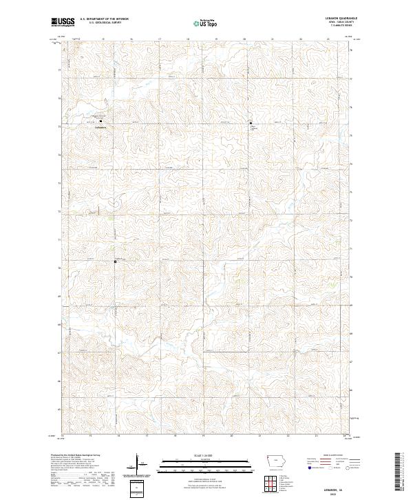
2022 Map of Lebanon
USGS Topo · Published 2022About this map
Lebanon serves as the quiet geographic center of this Sioux County landscape, situated where 20th St NE meets Dogwood Ave. The map reveals a deeply rooted agrarian community defined by its spiritual and commemorative landmarks, including the Lebanon Christian Church and its adjacent Lebanon Christian Church Cem. Further south, the Highland Cem and Peace Lutheran Cem are established along the section lines, providing essential points of reference for genealogists tracing local family histories. The drainage pattern is dictated by several winding waterways, most notably Sixmile Cr, which meanders across the southern half of the quadrangle, alongside Dry Cr and Spring Cr. This network of creeks and a rigid grid of gravel and paved roads, such as Co Rd K30 and Co Rd B40, illustrate the organized land division typical of the Iowa plains.
Find a feature on this map
30 named features on this map. Tap any name to fly to it.
Don’t see what you’re looking for? This feature index may not catch every label — zoom into the map to look around manually.
Map Details
Editions of this 2022 Lebanon Map
This is the sole edition of this map. No revisions or reprints were ever made.
Other maps of this area

1955 · Sioux City
USGS Topo · 1:250,000

1955 · Sioux Falls
USGS Topo · 1:250,000

1958 · Sioux City
USGS Topo · 1:250,000

1958 · Sioux Falls
USGS Topo · 1:250,000

1959 · Sioux City
USGS Topo · 1:250,000

1962 · Le Mars
USGS Topo · 1:62,500

1964 · Sioux Center
USGS Topo · 1:24,000

1964 · Hull
USGS Topo · 1:24,000
1968 · Hawarden North
USGS Topo · 1:24,000

1968 · Fairview
USGS Topo · 1:24,000