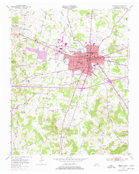
1951 Map of Lebanon
USGS Topo · Published 1977About this map
Lebanon serves as the focal point of this mid-century Wilson County survey, centered around the Courthouse and the historic campus of Cumberland University. The town's residential expansion is evident in neighborhoods like West End Heights and Highland Heights, while its educational and military character is underscored by the Castle Heights Military Academy. This map records a critical period of infrastructure growth, showing the Lebanon Airport and the prominent Louisville and Nashville railroad corridor that defined the local economy.
Find a feature on this map
74 named features on this map. Tap any name to fly to it.
Don’t see what you’re looking for? This feature index may not catch every label — zoom into the map to look around manually.
Map Details
Editions of this 1951 Lebanon Map
4 editions found
Other maps of this area

1942 · Statesville
USGS Topo · 1:100,000

1942 · Gallatin
USGS Topo · 1:100,000

1942 · Lebanon
USGS Topo · 1:100,000

1951 · Lebanon
USGS Topo · 1:24,000

1951 · Martha
USGS Topo · 1:24,000

1955 · Laguardo
USGS Topo · 1:24,000

1955 · Hunters Point
USGS Topo · 1:24,000

1956 · Vine
USGS Topo · 1:24,000

1956 · Gladeville
USGS Topo · 1:24,000

1956 · Nashville
USGS Topo · 1:250,000