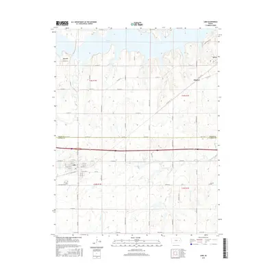
2015 Map of Lebo
USGS Topo · Published 2015About this map
Melvern Lake dominates the northern reaches of this landscape, its fingers reaching into the surrounding terrain near the small settlements of Arvonia and Olivet. The map illustrates a primarily agricultural and rural section of the Kansas plains where the Osage Co and Coffey Co boundary line divides the quadrangle. The town of Lebo serves as a central hub, featuring a traditional grid of streets such as W Broadway St and W Sac & Fox St. The surrounding countryside is defined by a network of drainage creeks including Coal Cr, Lebo Cr, and Frog Creek. Further east, the small community of Ridgeton sits along W Olivet Rd. The rural character is reinforced by the presence of a lone Cem near Key West, providing a clear look at the dispersed nature of local history and family landmarks in the region during the early 21st century.
Find a feature on this map
64 named features on this map. Tap any name to fly to it.
Don’t see what you’re looking for? This feature index may not catch every label — zoom into the map to look around manually.
Map Details
Editions of this 2015 Lebo Map
This is the sole edition of this map. No revisions or reprints were ever made.
Other maps of this area

1885 · Burlington
USGS Topo · 1:125,000

1889 · Burlingame
USGS Topo · 1:125,000

1894 · Burlingame
USGS Topo · 1:125,000

1894 · Burlington
USGS Topo · 1:125,000

1947 · Lawrence
USGS Topo · 1:250,000

1950 · Lawrence
USGS Topo · 1:250,000

1956 · Lawrence
USGS Topo · 1:250,000

1957 · Lebo
USGS Topo · 1:24,000

1957 · Waverly NW
USGS Topo · 1:24,000
1957 · Lebo NW
USGS Topo · 1:24,000