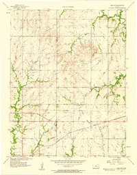
1957 Map of Lebo NW
USGS Topo · Published 1958About this map
Neosho Rapids sits along the southern edge of this mid-century landscape, positioned near the intersection of the Atchison Topeka and Santa Fe railroad and the river system. The map documents a strictly rural environment across the corners of Lyon, Osage, and Coffey counties, divided by the historic Old Indian Boundary. This line marks a significant shift in the 19th-century land division that still influenced property boundaries and road placements at the time of this 1950s survey.
Find a feature on this map
23 named features on this map. Tap any name to fly to it.
Don’t see what you’re looking for? This feature index may not catch every label — zoom into the map to look around manually.
Map Details
Editions of this 1957 Lebo NW Map
3 editions found
Other maps of this area

1885 · Eskridge
USGS Topo · 1:125,000

1885 · Burlington
USGS Topo · 1:125,000

1888 · Emporia
USGS Topo · 1:125,000

1889 · Burlingame
USGS Topo · 1:125,000

1889 · Eskridge
USGS Topo · 1:125,000

1894 · Emporia
USGS Topo · 1:125,000

1894 · Eskridge
USGS Topo · 1:125,000

1894 · Burlingame
USGS Topo · 1:125,000

1894 · Burlington
USGS Topo · 1:125,000

1947 · Lawrence
USGS Topo · 1:250,000